Need an interesting read?
Check out the JRC paper on
‘Forecasting the impacts of climate change on inland waterways’
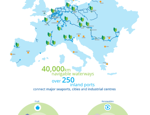
The Joint Research Centre (JRC), the European Commission’s science and knowledge service, has recently published a study that evaluates the economic implications of climate change for the inland waterways transport. The focus was put on the impact of low water levels and the uncertainty associated with climate projections. Clearly, there is a link between inland waterways and climate change since the navigation on the rivers depends on water levels.
The researchers come to a conclusion that European inland waterways appear to be one of the few sectors where climate change can have negligible or even positive impact even in the ‘worst case’ emission scenario. Most climate models simulate an increase of the discharge levels of the main inland waterways routes – the Rhine and the Danube – most probably due to earlier start of the melt season. The projected discharge levels would result in a higher average of water levels and – most importantly – would reduce the number of days with a water level below the minimum required for navigation.
And why is that?
Due to the nature of an inland waterways’ network, the location-specific characteristics (that define the gauge or discharge levels) have to be taken into account in order to evaluate the impact of projected discharges. The study had focused on four points on the Rhine and the Danube that are critical for the operation of the inland navigation system across Europe as a whole. The selected points are:
1. Wildungsmauer on Danube,
2. Hofkirchen on Danube,
3. Ruhrort on Rhine,
4. Kaub on Rhine.
The researchers identified location-specific discharge limits and then compared the expected daily simulation results against them. They have analysed the impacts of droughts induced by climate change using projections of river discharge data provided by eleven different climate model runs. This has allowed to capture any value below the limits, regardless of the season, and address the issue identified by Jonkeren et al. (2014) as regards the need to explore (increasing) winter and (decreasing) summer discharges separately. Uncertainty has been taken into account by considering various climate change scenarios. Furthermore, the projection’s potential of the navigability of the rivers is significantly improved by using discharges from a dynamic hydrological model.
The results for the selected points show that for two points on the Danube the number of low water days is projected to decrease, while a similar trend is projected for Kaub on the Rhine, leading to an overall positive average economic impact. More specifically, the average annual economic benefits of the decrease of low water levels by the end of the century for Kaub, Wildunsmauer and Hofkirchen were projected to be €31million, €6million and €4million, respectively. On the other hand, an average annual economic loss of €10million has been estimated for Ruhrort, as a result of the projected increase of the average number of low water days by the end of century.
However, given the relatively moderate impact estimates and large uncertainty associated within different model runs, the researchers consider that the results do not indicate a significant impact of climate change on the operation of inland waterways. This is in line with the findings of Beuthe et al. (2014) who conclude that limited change would have a minimal impact on waterway’s navigation while modest effect of climate changes on modal shift were estimated by Jonkeren et al. (2014) and Beuthe et al. (2014).
There is a location-specific nature of the relationship between discharges and water levels, which does not allow generalising this outcome, but the variation of projections of the model runs indicates that the risks of droughts should not be ignored.
It is important to note that for the inland waterways to work as a system, all parts of the system should operate without disruptions. The sample of four points used in the study is only a preliminary indication of the direction of the impacts for inland waterways. As described in the case of projections for Ruhrort, in some scenarios and under specific conditions, one or more points of the IWW may face low water levels, even if the other points do not. This is probably the case in the Danube with increasing discharges in the upper Danube, while the lower Danube showing a decrease in water availability in the future (Bisselink et al., 2018). In such cases, depending on the network connections and vessels traffic, the disruption in one point can indirectly affect the rest of the system.
Theresia Hacksteiner
1 March 2021


